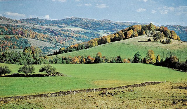
Vermont is filled with stunning vistas, charming towns and peaceful countryside.
This summer, explore some areas of the Green Mountain State you’ve never seen before by getting off the main roads and traveling some of Vermont’s loveliest back roads, suggested by the Vermont Department of Tourism.
Stowe and the Northern Mountains
Begin in Stowe — 125 miles
- From the village of Stowe, take Route 100 north about 2 miles, then the left fork onto Stagecoach Road, follow it for about 6 miles.
- Turn left at the stop sign onto French Hill Road (Walton Road at the far end). Follow it to a right turn onto White Road, which is not marked.
- Travel into Johnson on Railroad Street to the intersection with Route 15. Turn right onto Route 15 through Johnson village and go past the junction of Route 100 and Route 15.
- Travel about 6 miles, then turn right onto Route 100 at the stop light. Follow it to a blinking light in Morrisville.
- Turn left onto Greaves Hill Road, then left onto Couchaine Farm Road (becomes Elmore Pond Road), and follow it to Route 15. Turn left onto Route 15, then take the first right turn onto West Hill Road.
- Take a right onto North Wolcott Road and go 8 miles, turn left just past the cemetery to the Gulf sign, then left again 7 miles to Eden Mills.
- In Eden Mills, turn left onto Route 100, go abut 1 mile then turn right onto Route 118. Follow it to the intersection with Route 109 in Belvidere Corners, take Route 109 west through Belvidere Center to Waterville.
- Take the second left onto unpaved Hogback Road. Take a sharp right onto Route 15, and follow it through Cambridge and Jeffersonville, to the intersection with Route 108.
- Turn right onto Route 108 and follow it through Smugglers Notch, about 18 miles to return to Stowe. Note that the Notch road is winding and narrow (unsuitable for large vehicles) and closed in the winter.
Alternative: Take the Toll Road up to the top of Mount Mansfield, and take in the views.
Northern Mountains and Islands
Begin in St. Albans — 120 miles
- Take Route 105 from St. Albans east through Steven Mills to the intersection with Route 101.
- Take 101 south 1 mile, then turn right onto Route 242 and follow it to Montgomery Center.
- In Montgomery Center, turn left and go south on Route 118 to Belvidere Coners, then turn right onto Route 109 and take it to Jeffersonville.
- Take Route 104 from Jeffersonville through Fairfax on Route 104. About 2 miles north of Fairfax, turn left onto Route 104A, and follow it to Interstate 89. Take I-89 south to exit 17 at Chimney Corner, turn onto Route 2 all the way through North Hero, Grand Isle and South Hero.
Take a side trip on Route 129 to Isle La Motte, then return to Route 2.
Other lovely stops include Sand Bar State Park, Niquette State Park.
To shorten the route and stay on the lake, head east on Lake Road (Route 36) in St. Albans. Follow it along the shore until you connect with Route 78. Follow Route 78 north, then turn south onto Route 2.
Short Charlotte and Ferry Loop
Begins in Hineburg, approximately 30 miles, plus ferry travel
- Take Hinesburg Road into Charlotte, turn left onto Mount Philo Road.
- At Mount Philo State Park, drive up to the top of the mountain ($3 fee per person) for a panoramic view of Lake Champlain and the Charlotte farmland below.
- Take State Park Road and turn right onto Route 7. Turn left onto Ferry Road, through the village of Charlotte.
- Turn left onto Lake Road, then right onto Converse Bay Road, which is unpaved. Follow Converse Bay Road to the ferry dock.
- Take the ferry across the lake to Essex, N.Y., stopping for a bite at the Old Dock or an ice cream cone.
- Return on the ferry, and take Ferry Road, which will become Hinesburg Road.
Classic Vermont Villages and Covered Bridges
Begins in Middlesex, 110 miles
- Beginning in Middlesex village, take Route 100B to Moretown.
- In Moretown village, take a sharp left, turn up a hill and onto an unpaved road, Moretown Mountain Road, which meanders for several miles before becoming Cox Brook Road. Near the end of the unpaved road, you will pass or pass through three covered bridges.
- In Northfield Falls, turn right onto Route 12. Take it to the intersection with Route 12A. Take Route 12A to Roxbury village, then turn right onto an unpaved road, Warren Mountain/Roxbury Mountain Road, and follow it to East Warren. Turn left to Warren to see another covered bridge. The Warren Store in Warren on Route 100 is a good place to stop for lunch—eat out on the deck overlooking the river.
- Backtrack on Common Road to East Warren and take it to Waitsfield Common, then take North Road (later becomes Pony Farm Road) back to paved Route 100, just south of Moretown.
- Turn left onto Route 100 and follow it through Waitsfield. Look for covered bridges on the left in the village. Continue through Irasville and take a right turn onto Sugarbush Access Road.
- Take a right onto German Flats Road, then left onto Route 17. Travel west for about 8 miles. Take a sharp right onto unpaved Gore Road/Main Road through Hanksville, Huntington Center and Huntington, where the road becomes Huntington Road.
- Take a right on unpaved Dugway Road. At the end of the road, turn right onto Cochran Road, and follow it to Route 2. Turn right onto Route 2 and follow it through Bolton and Waterbury to the intersection with Route 100.
- Take Route 100 through South Duxbury. Turn left onto Route 100B, follow it through Moretown and back to Middlesex and the intersection with Route 100.
For more scenic drive suggestions, visit the Vermont Department of Tourism’s website at Vermontvacation.com.


This article was contributed by Stehpanie Choate.
 Related Articles & Free Subscription
Beginning Retirement in Vermont

Excursions Off the Beaten Track
Free Subscription to Vermont Maturity Magazine

Comment here